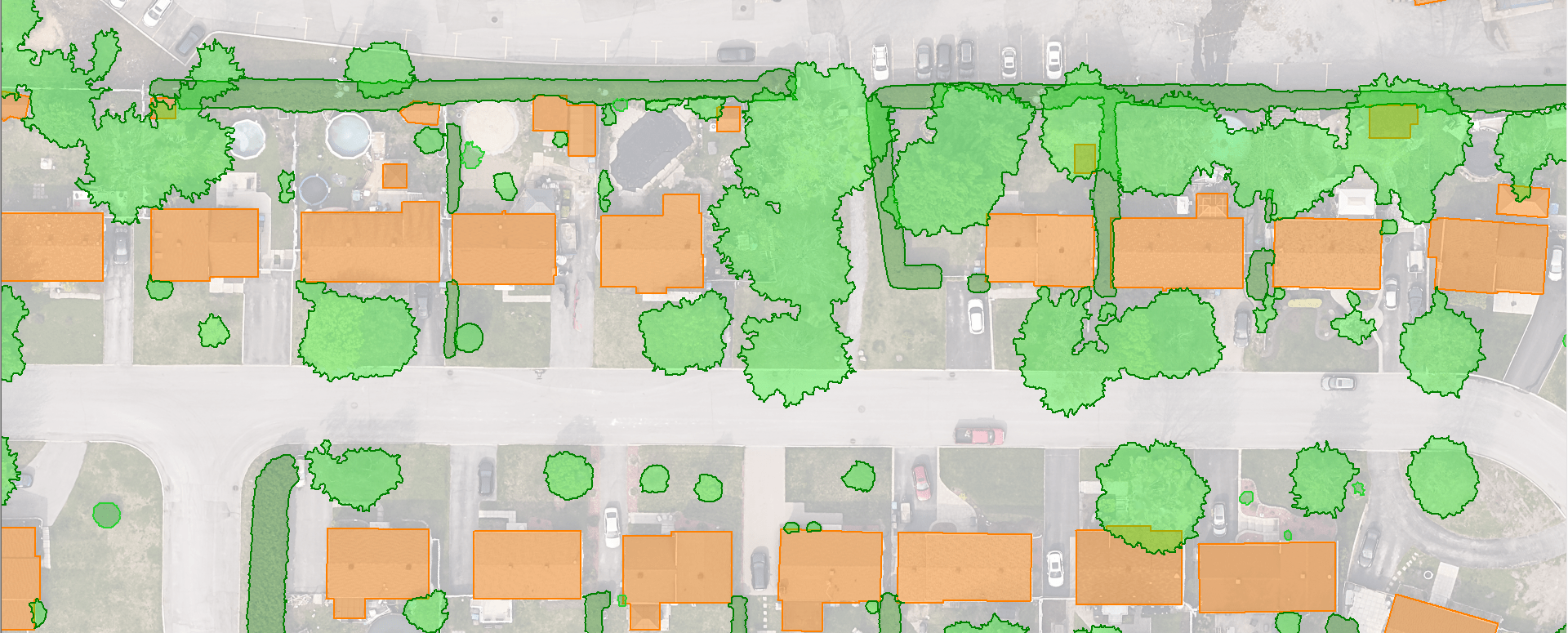
Végétation regroupée
La cartographie de la canopée représente une vue en plan de la couverture végétale par classe de hauteur 0,5 à 1,2m, 1,2 à 3m, 3m et +.
Des couches cartographiques séparées représentent les haies sous forme de polygones ainsi que leur centreligne.
Caractéristique du produit
La cartographie de la canopée est extraite d’un nuage de points LiDAR classifié par intelligence artificielle avec une méthode en cours de brevet par XEOS Imagerie.
Elle n’inclut que la végétation; toute autre information (ex. : poteaux, cabanons, fils électriques, clôtures, véhicules, etc.) a été exclue de la végétation.
Les classes de hauteur priorisent les classes les plus hautes. Ainsi, si un arbre de 20 m de haut est au-dessus d’un arbre de 2,5 m de haut, ils seront inclus dans le polygone de la classe 3 m et +.
Pour consulter les termes et conditions d’utilisation, veuillez vous référer à notre licence générale d’utilisation.
Pour qui:
- Les villes
- Les aménagistes du territoire
- Les architectes
- Les entreprises de télécommunications
- Etc.
Format de fichier : .SHP (polygone 2D) et .SHP (ligne 2D)
Accéder à la démo gratuite :
- Aller sur le site de vente de XEOS Imagerie
- Connectez-vous ou créez vous un compte
- Taper « Repentigny, Quebec, Canada » dans la barre de recherche
- Cliquer sur le « + » à côté de « Données cartographiques »
- Cliquer sur « échantillon gratuit » en dessous de « Type de produit : Végétation regroupée »
- Cliquer sur « Commander »
- Renseigner vos informations
- Lire et accepter la licence générale d’utilisation
- Cliquer sur « Passer la commande »
- Vous recevrez par mail le lien et le code pour télécharger le fichier via WeTransfer
