
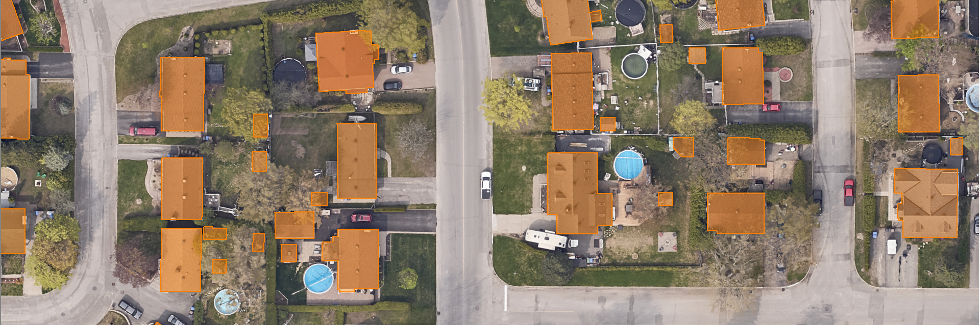
Building footprints
Building footprint mapping corresponds to a building’s boundaries projected onto the ground, as seen from the sky.
Product features :
The footprint is extracted directly from a LiDAR point cloud classified by artificial intelligence using a patented method developed by XEOS Imaging.
The height of each building, calculated from the median ground level elevation around the building, is associated as an attribute.
Accuracy depends on the lidar data source. Using XEOS’s proprietary configuration, it is possible to achieve approximately 10 cm precision in XY.
Sheds and buildings under tree cover are generally well detected, especially if the LiDAR acquisition was carried out in spring or autumn. Some buildings, however, may not be detected if they are not present in the LiDAR point cloud. This sometimes happens with tin roofs, new black asphalt shingles or glass roofs.
For whom :
- Cities that want to detect changes that have been made without a permit or identify dwellings in flood-prone areas
- Land surveyors
- Architects
- Telecommunications companies
- etc.
File format : .SHP (2D polygon)
To view the terms and conditions of use, please refer to our general user license.
Order online :