
Culverts
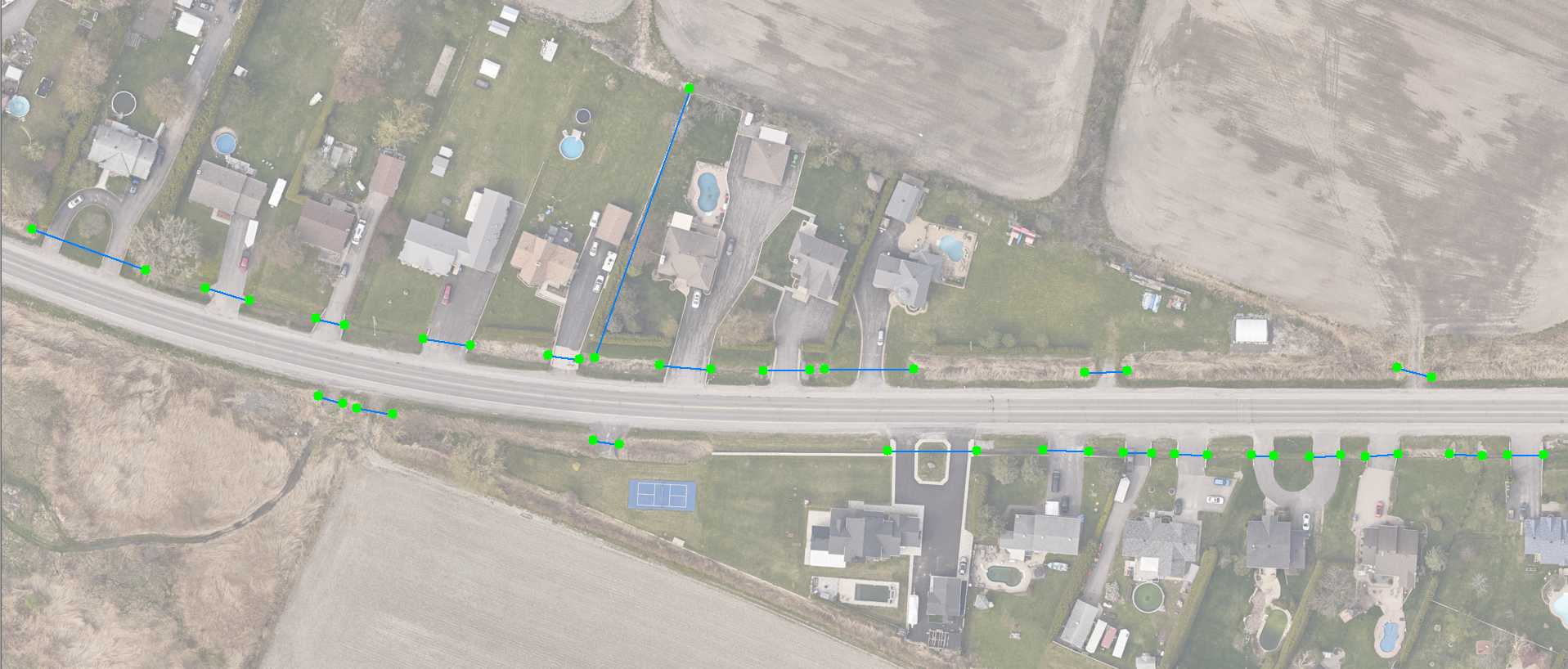
The culvert mapping indicates the location of each culvert as a line representing the buried pipe, along with the locations of the culvert ends as points. The drainage area associated with each culvert is provided as a polygon.
Product description:
Culvert mapping is extracted from a LiDAR point cloud classified using XEOS Imaging’s AI technology, patented in Canada and Europe and patent-pending in the United States and Australia.
The surface area of the drainage basin associated with each culvert is provided as an attribute.
The ground permeability of the drained area (% permeable / % impermeable) is calculated by artificial intelligence from aerial imagery when available.
Accuracy depends on the lidar data source. Using XEOS’s proprietary configuration, it is possible to achieve approximately 10 cm precision in XY.
Attributes:
• The surface area of the drainage basin for each culvert (in hectares)
• The proportion of the drained area with permeable ground
• The proportion of the drained area with impermeable ground
For whom :
• Municipalities and regional county municipalities (RCMs)
• Departments of Transportation
• Civil engineers and engineering consulting firms
• Hydrology and stormwater management specialists
• Etc.
File format: .SHP
To view the terms and conditions of use, please refer to our general user license.
Order online :